A warm welcome and reunion. For a while I'll rest from my travels.
Tuesday, July 27, 2010
This place is eerie and haunting. Emigrants numbering around 400,000 traveled across Wyoming on the Oregon Trail from 1840-1860. My family on my father's side, Sowbys and Pettigrews, were on the Trail. Reaching Independence Rock marked 1/3 of the 2,000 mile distance from Missouri to the western frontier. Independence Rock is one of the most famous landmarks on the Oregon Trail. Emigrants wanted to reach the rock by the 4th of July to ensure passage over the western mountain ranges before winter snows.
Rachel Taylor, age 15, 1853, wrote in her journal:
July 21st
Started in good season and about noon reached the Sweetwater, a swift clear stream. Later in the day passed Independence Rock. We forded the river here and were somewhat hindered. Encamped near the river where grass is abundant. We have here a frightful as well as romantic situation. Just back of us Independence Rock stands out in bold relief, and in front of us yawns the Devils Gate.
Cecelia Adams & Parthenia Blank, twin sisters, age 23, 1852, wrote:
25 Sun this morning we started at 3 o’clock to feed and get breakfast. Sand very deep and dust very troublesome. Stopped for dinner opposite Independence Rock. It is a great curiosity but we were all so tired that we could not go to the top of it. It is almost entirely covered with names of emigrants. Went on to the Devil’s Gate and encamped. This is a great curiosity but we have not time to visit it and regret it very much. Passed 3 graves. Forded the Sweet water.
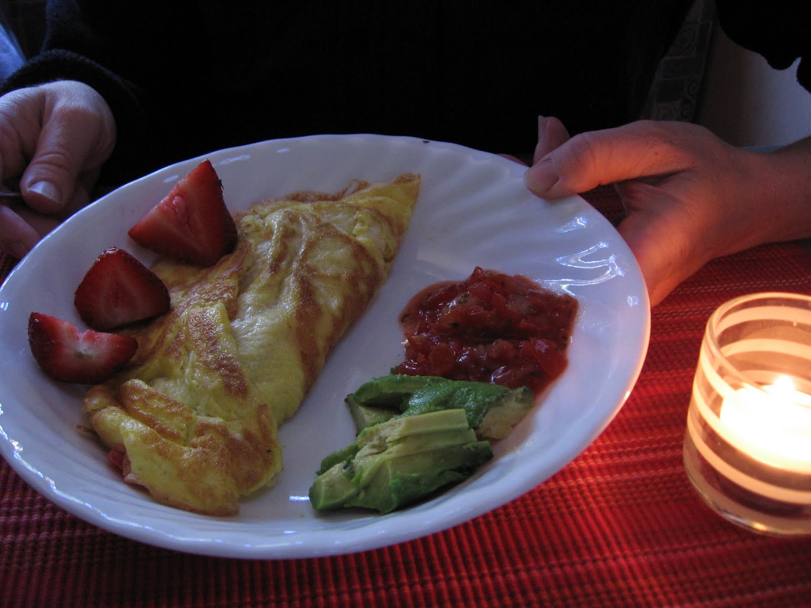
Breakfast in the T@B by Ashley; spinach & tomato omelets with the trimmings yumm.
Surprised & humbled by the Grand Tetons in all their glory. We wanted to canoe on Jenny Lake, but no parking in an overcrowded parking lot! Instead, a beautiful new Interpretive Center awaited us with a(nother) string quartet playing on the patio. Wow!
Yellowstone National Park, established on March 1, 1872, is the world's oldest National Park. It is famous for having more than 10,000-plus hot springs and geysers, the majority of the planet's total. (In two days we saw only about 20.)Yellowstone's geothermal features are created by one of the world's largest active volcanoes; its last eruption caused a crater or caldera that spans about half of the parks size.
The area in the photos is Grand Prismatic Spring, Yellowstone's largest hot spring, 370 feet in diameter. It's in the Midway Geyser Basin reached by following a boardwalk. The spring is deep blue in color, with yellow and orange rings formed by bacteria that give it the effect of a prism--more beautiful than photos or words can describe.
John Colter, the first white man known to see Yellowstone, was on the Lewis and Clark Expedition. Before the Expedition returned to St. Louis, Colter asked to be released from duty to return to the wilderness. In 1807 he and former expedition member John Potts , trapping in Blackfeet country, were ambushed by Indians. Potts was killed, but Colter escaped by outrunning the Blackfeet who had stripped him naked; he ran 200 miles to safety. Later Colter supplied Clark with many new details from his travels into the Yellowstone(Lewis & Clark somehow missed it). In describing the geysers and other geothermal phenomena, Yellowstone Park became known as “Colter’s Hell.”
We saw people from all over the world visiting Yellowstone 200 years after these historic events. A family from Denmark visited with us after Old Faithful blew. We loved the restored Old Faithful Inn, and stayed 92 minutes to watch Old Faithful again from the Inn balcony.
The Beartooth Highway in Montana is one of the most spectacular alpine highways in North America. Providing visitors access to Yellowstone Park's northeast entrance, the Beartooth Highway makes its way across the rugged Beartooth Mountain Range in Montana and Wyoming. The road is the highest elevation highway in the Northern Rockies. We saw people play in the snow. Naturally we would choose the most challenging way to enter Yellowstone Park; there was little traffic at the remote NE entrance to the Park.
First Peoples Buffalo Jump State Park, formerly known as Ulm Pishkun, is an archaeological site with possibly the largest bison cliff jump in North America. Native peoples used this site for at least two thousand years prior to Lewis and Clark's expedition through Montana. The kill site consists of a mile long sandstone cliff; there are remnants of drive lines on top of the cliff and the remains of millions of 'processed' bison below. The process of tricking the bison was done before 1730 when Plains Indians did not have horses; a successful hunt require the coordinated work of all members of the tribe. The buffalo was sacred to the Plains Indians; the result of the annual kill resulted in the starvation or survival of the tribe.
Tuesday, July 13, 2010
We enjoyed the Charles Russell Art Museum in Great Falls. Among his many art forms, Russell would put art into his letters to friends. This note is thanking friends for ? that he and his wife, Nancy, were given. This place has been one of my favorite stops on the trip.
On to Helena, the capital of Montana. We arrived late in the afternoon and parked the tab at the curb in front of the beautiful capital bldg., and had burritos in the T@B. Not one car passed on the street as we had dinner. The red flowers are arranged to say, "Montana, 2010".
Ashley prepares to dive into the Giant Springs; from a fracture in the Earth's limestone, water flows upward at a force of 300 pounds per square inch, discharging 156 million gallons per day. William Clark discovered this June 18th, 1805, "we proceeded on...to the largest fountain or Spring I ever Saw. and doubt if it is not the largest in America Known, this water boils up from under th rocks near the edge of the river and falls imediately into the river 8 feet and keeps it Colour for 1/2 a mile which is emencely Clear and of a bluish Cast..." (sic).
We enjoyed the astonishing Great Falls at high water flow as described by Meriwether Lewis on June 14th, 1805 "...hearing a tremendious roaring above me I continued my rout across the point of a hill a few hundred yards further and was again presented by one of the most beautifull objects in nature, a cascade of about fifty feet perpendicular streching at right-angles across the river from side to side to the distance of at least a quarter of a mile...the water decends in one even and uninterupted sheet to the bottom wher dashing against the rocky bottom rises into foaming billows of great hight and rappidly glides away. hising flashing and sparkling as it departs the sprey rises from one extremity to the other..."(sic).
Ashley arrived in Great Falls July 11, and we went over to the Lewis & Clark Interpretive Center to help the Corps of Discovery portage the dugout canoes around the 18 mile stretch of waterfalls on the river. Ashley's strong muscles required only a light touch, and my pulling on the rope hardly made a speck of difference.
Tuesday, July 6, 2010
4th of July parade in Arnegarde, North Dakota; The Missouri-Yellowstone Confluence; Fort Buford; Fort Union Trading Post National Historic Site; Fort Peck Dinosaur Bones
My T@B was invited to be in the parade for the 4th with the energetic/creative WIN RV group. We had a fine time--more photos on this later.
The Corps of Discovery first saw confluence of these two great rivers April 5,1805. Lewis wrote, "I ascended the hills from whence I had a most pleasing view of the country...The whole face of the country was covered with herds of buffalo,elk, and antelopes...so gentle that we pass near them while feeding without appearing to excite any alarm among them." That was what I experienced driving into the Roosevelt
campground--lots of bison who took no notice of me!
The historian in my photo at Fort Union explained how it was the "Walmart" of the west, owned by businessman John Jacob Astor who made a fortune knowing how to do business with the indian tribes. I was served hot coffee from a pail over the fire (very tasty) and looked over the trade goods in his shop; one item was a fancy officer jacket which cost 18 buffalo robes!
On down Hwy. across Montana, I stopped at the Fort Peck Dam Interpretive Center where fabulous dinosaur skeletons were reconstructed. I am in the Havre Library as I write this on a rainy day. Thank you for your comments & keeping in touch on my travels. Credit to Diana Tolerico for her photo of me on the hike.
Wednesday, June 30, 2010
June 26-27 Pierre, South Dakota
June 28 Fort Lincoln, Mandan, North Dakota,
Fort Mandan: The Expedition's first winter
June 29 Theodore Roosevelt National Park, N.D.
The photo of Lewis & Clark is at Fort Mandan,N.D., a reproduction because the original no longer exists. The Fort was built a few miles from Mandan and Hidatsa villages who were friendly and provided corn in exchange for axes that were made in the Fort by the blacksmith. Because of extensive Indian trading, one of those axes arrived in the Columbia River Gorge area before Lewis & Clark got there the following spring! There is a great interpretive center near Washburn, N.D. where I tried on a buffalo skin 'coat'. It was so heavy it was difficult to walk around in it. Also there was a cradle board with a doll baby that I tried to lift but it was very heavy. This would have been how Sacajawea carried Pomp (Jean Baptist Charbonneau) around on her back; she had to be a strong woman.
The photo of the keel boat is a reproduction of the main vessel that carried the Expedition's tons of goods upriver to Fort Mandan and then returned downstream in 1805 to carry the nature specimens and journals and notes up to that time to President Jefferson. This reproduction is on the waterfront in Bismarck, N.D.
Just the work of traveling even with all the improved technology that I have 200 years later, takes a toll. I find that everything must have a place and be returned to that place and be clean and in repair. Much of the Expedition's time must have been spent on this. Also, the journaling which was to take place every evening, was another job on the Trail. I find that sitting down and getting settled to write seems practically impossible with every day changing, sometimes arriving late at a camp site thinking more of food & sleep.
The past two nights I've spent in Theodore Roosevelt National Park. The area is beautiful and environmenally pristine. The Park takes pride in it's thriving eco systems and clean air and clear skies. It is a little like Eden staying here. Driving along, buffalo come walking down the road toward me--and take little interest. Buffalo can run 35 mph and turn faster than a horse, so we tourists are cautioned to take it easy around the bison.
Pres. T. Roosevelt came out here as a Harvard graduate, city-bred, asthmatic, skinny and weak. He took to cowboy life, and became a changed man in about 3 years. He claimed that the Dakota Badlands brought him vitality & health. He was an avid reader and writer; always had a book with him. He was great conservationist; he is credited with saving 5 National Parks and many National Forests.
Saturday, June 26, 2010
South Dakota family ties
My mother was born in Sioux Falls and I decided to do a little poking around in the family tree while in South Dakota. The highways are laid out like a checkerboard here mostly heading north & south, or east & west. I drove straight north past miles of flooded fields dotted with occasional farmhouses to Aberdeen in NE South Dakota.
Mother has memories of Grandpa John Thomas Bell living here as a successful businessman. His daughter, Cora Bell, 6 months, is listed in the US census of 1880. She was married to Robert Bigford Gage, b. 1879 for only a year, and then Mr. Gage 'disappears' from our story. Their son, Kenneth Homer Gage, b. 17 July 1899, my grandfather, was raised by his grandfather. Kenneth went to work one summer around 1919 in Mr. Bell's dry cleaning(?) business in Sioux Falls where one day he saw young Nellie Langstraat, my grandmother and married her. They might have stayed in Sioux Falls except that Kenneth learned about opportunities in California. The Anza desert was being homesteaded. He moved his wife and baby (mother) in the early 1920s to the west, and Cora came out to live in Anza on a homestead complete with windmill & well. I remember my great grandma Cora as we visited her there when I was small in the 1950s.
I imagine if our family story had gone differently, I might be a citizen of South Dakota instead of California. I've been impressed with the people and the wide open spaces here. The kids are polite and the people hospitable. There are plenty of computers in the library, but the rule is still 'quiet', a good thing as I compose this chapter.
Our traveling group has been in Pierre, the capital, for a few days; the local paper did an article on us! This is where Lewis & Clark had a showdown with the Sioux. The chiefs didn't like the gifts they were offered, and wanted guns instead; they were the most antagonistic of all the tribes encountered. It turned out to be the beginning of the end for the Sioux culture which withered in the next 75 years.
I am looking forward to the next leg of the journey, Bismarck, North Dakota, and the Mandan village where the Corps of Discovery spent the winter of 1804-1805. Adieu for now!
Tuesday, June 22, 2010
June 19 borrow kayak for river trip
June 20 drive to Valentine, SD to meet group
June 21 sixteen of us on the Niobrara Scenic River
In just a few days I have made a number of new friends in the RV group, WIN, who are traveling the Lewis & Clark Trail. Many RVers started in St. Louis and will continue to Astoria, WA.
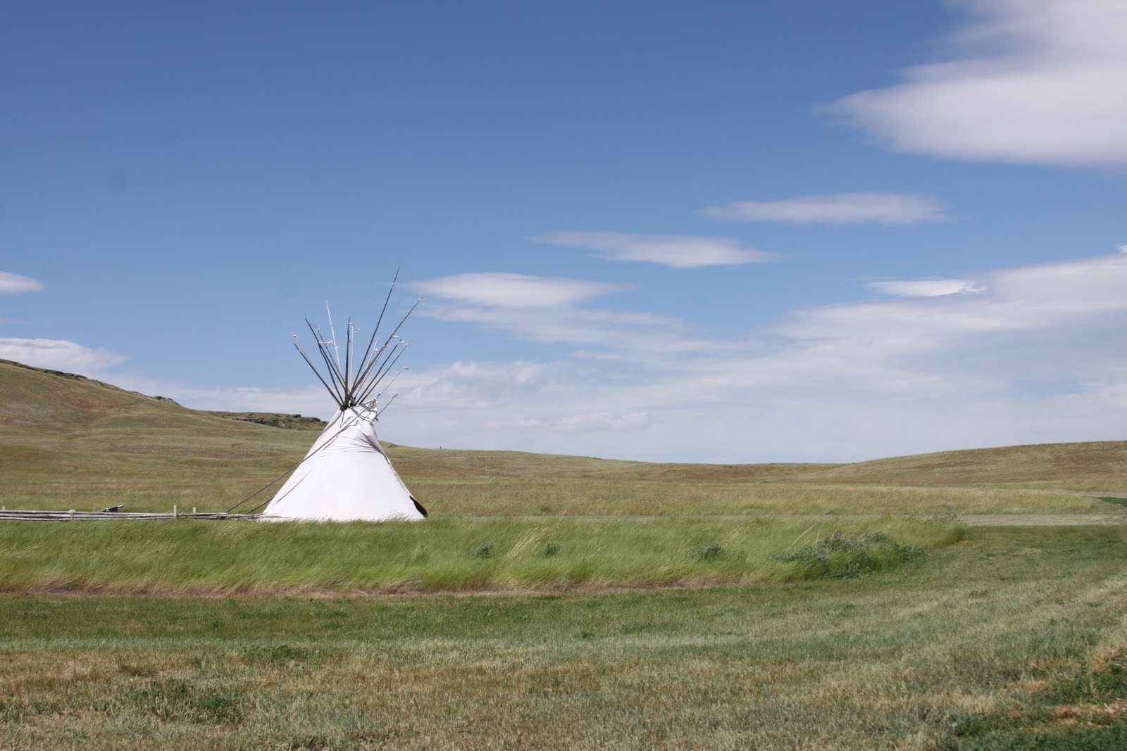
Yankton is the former territorial capital of South Dakota. Lewis and Clark held councils and feasted with the Yankton Sioux here August 28, 1804. They slept among shelters "of a Conic form Covered with Buffalow Roabs Painted different Colours" -- teepees. One of my favorite diary entrees of Sgt. John Ordway is, "After dark we Made a large fire for the Indians to have a war dance...the Band began to play on their little Instruments, & the drum beat & they Sang. the young men commenced dancing around the fire. it always began with a houp & hollow & ended with the Same, and in the intervales, one of the warries at a time would rise with his weapen & Speak of what he had done in his day." (sic)
The WIN group meets in the mornings and at 5 pm to celebrate birthdays, share the news of the day and plans for tomorrow. I wanted to go kayaking on the Niobrara National Scenic River with a group of experienced kayakers on a Class 1-2 for about 14 miles so drove west to Fishberry campground near Valentine, SD where the group was boondocking. Diane, a member who had to leave the group for a few days, volunteered to loan me her kayak. Luckily I had ordered crossbars for the Jeep before I left home and now they are coming in handy.
The put-in went smoothly; we had a sunny day on the river flowing abou 4 1/2 mph. We spotted a large spotted turtle and a large eagle in a tree on the bank. When a gust of wind blew off my hat and whenI reached for it, the boat began to fill and I went overboard! It didn't take long with the assistance of 3 nearby kayakers to get me going again. Luckily everything I had stayed dry in plastic bags, and my new nylon pants, $3.50 from Yankton Good Will, dried quickly. Later at our regular 5 pm meeting, I was presented with the 'roving rubber ducky', the prize for the kayaker who 'takes a swim'. It was such a large duck that I had to ask someone with a big rig to keep it for me. My photo was taken receiving this honor with much applause.
Subscribe to:
Posts (Atom)